Grizzly Flat Emigrant Trail
|
|
Author
Seth Owens
American River College,
Geography 350: Data Acquisition in GIS; Spring 2013
setesh42@gmail.com (916)213-2481 |
|
Abstract
The California-Nevada Chapter of the Oregon-California Trails Association in conjunction with the El Dorado National Forest has been searching for the route of the Grizzly Flat Emigrant Trail. The project has been ongoing since 2010. GPS is used to collect the location of period specific metallic artifacts found with metal detectors. The GPS data needs to be parsed and combined with regional information such as elevation and slope data. With the addition of already mapped routes and routes, detailed analysis of this data in a GIS setting may aid in the prediction of emigrant trails that have yet to be found.
|
|
Introduction
The Grizzly Flat Emigrant Trail in El Dorado County is one of many roads used by emigrants on their way to various locations on the west coast, including the California gold rush. The location of the trail was recorded on General Land Office maps in the 1870's. The actual route has been unmarked for more than a century. Recently several groups have taken an interest in this trail to preserve it historically and prevent further damage to it from logging and off road vehicle activities.
To better analyze data collected via GPS units and legacy maps, layers within a geographic information system representing various aspects of El Dorado County will be assembled and the data applied to them.
Approximate trail location is determined from GLO maps and plenty of historical research. The trail is located using metal detectors and in at least two cases, blazes (marks cut into trees) left behind by scouts to tell the group where an optimal path was.
Typical Metal Detector 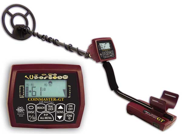 Because of the many artifacts left in the wake of a wagon train, metallic ones are the likeliest to have survived 150+ years in the ground. Metal detecting is a convenient way of locating the exact route of the trail based on the metal that was left behind. GPS is used to record the location of found objects and they are returned to the ground unless they have a particular value such as coins. Most metallic objects found are cut nails and broken wagon hardware, thus their value lies in where they were found as it represents an exact moment in time when that object was discarded or lost.
|
Project Area and Participants
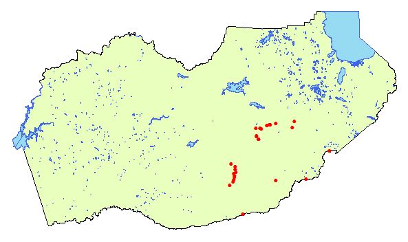
The sections of the trail currently mapped are along Baltic Ridge in El Dorado County, near the town of Grizzly Flat.
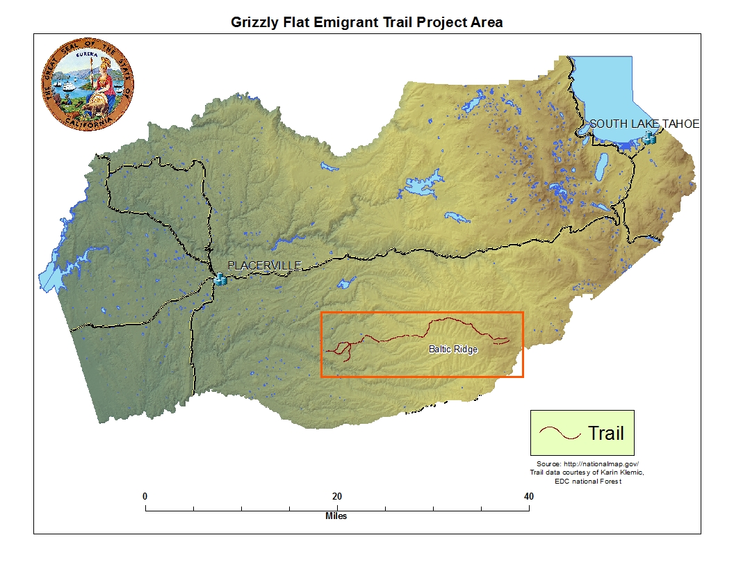
Photo credit: Seth Owens
|
California-Nevada Chapter Oregon-California Trails Association
The California-Nevada Chapter is one of eleven chapters of the Oregon-California Trails Association, an organization dedicated to the preservation, appreciation and enjoyment of all transmigration trails to the west, the trails that made the United States an ocean-to-ocean nation.

Photo credit: http://www.canvocta.org/
| |
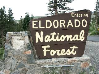
Photo credit: www.forestcamping.com
The El Dorado National Forest
The El Dorado National Forest has countless archaeological and historical sites within its boundaries and needs to preserve them and their locations for future generations, while at the same time facilitating the needs of logging companies, off road vehicle users, and the public in general.
| |
Trails West
Trails West, Inc marks the start of a trail with a crosspiece made of railroad track, painted beige. Different trails and states have different naming systems, the Grizzly Flat Trail markers are CR-55 and CR-56 (Carson Road). They have produced a book detailing their activites and locations of trails for the purpose of tourism, in many cases requiring off road capable vehicles.
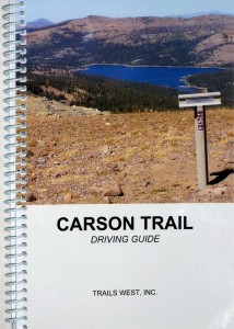
Photo credit: emigranttrailswest.org
| |
|
Volunteers and Artifacts
Two Volunteers in their metal detecting gear.
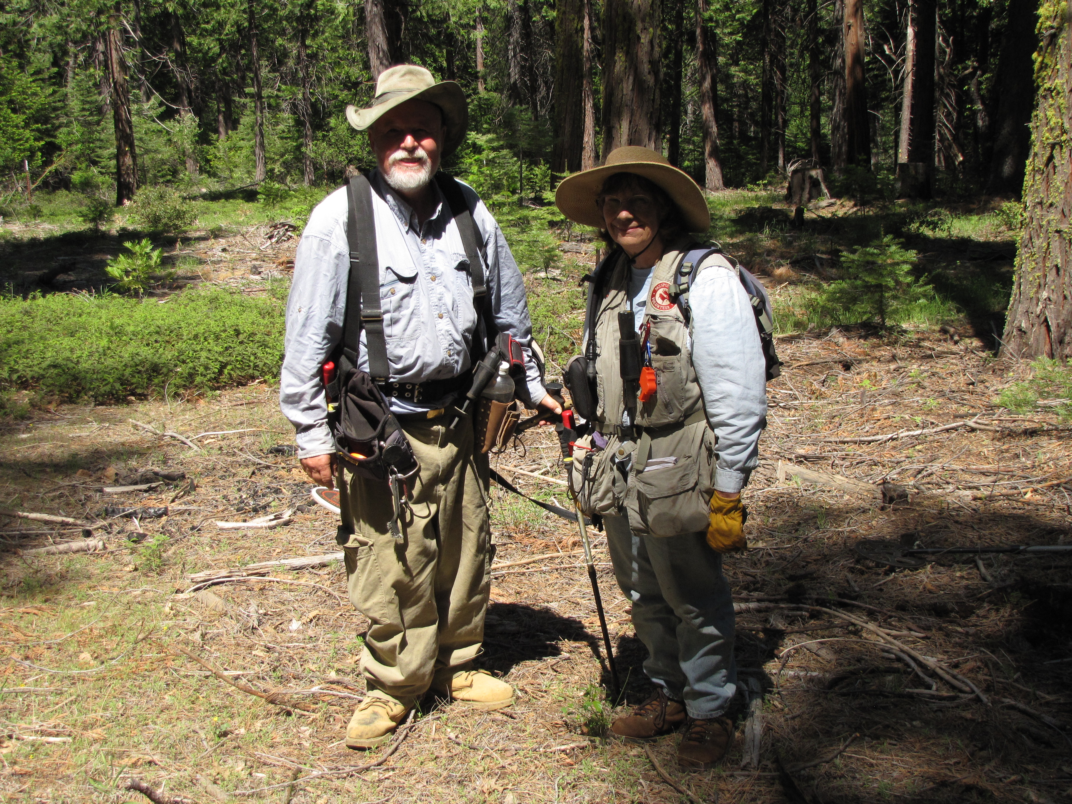
Photo credit: Dee Owens, Photo is Dee and her Husband Glen
Artifacts
This gun was found along the trail and dates to the timeframe when the trail was in use. Artifacts like this are often curated because of their uniqueness or because they represent a specific time period.
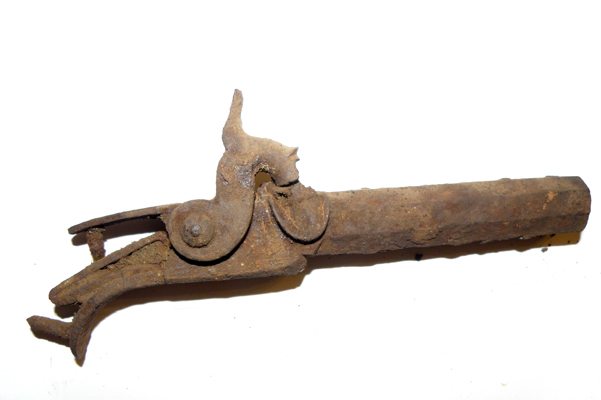
Photo credit: Dee Owens
Cut nails, ox and horse shoes, and most other miscellaneous bits of metal were not curated.
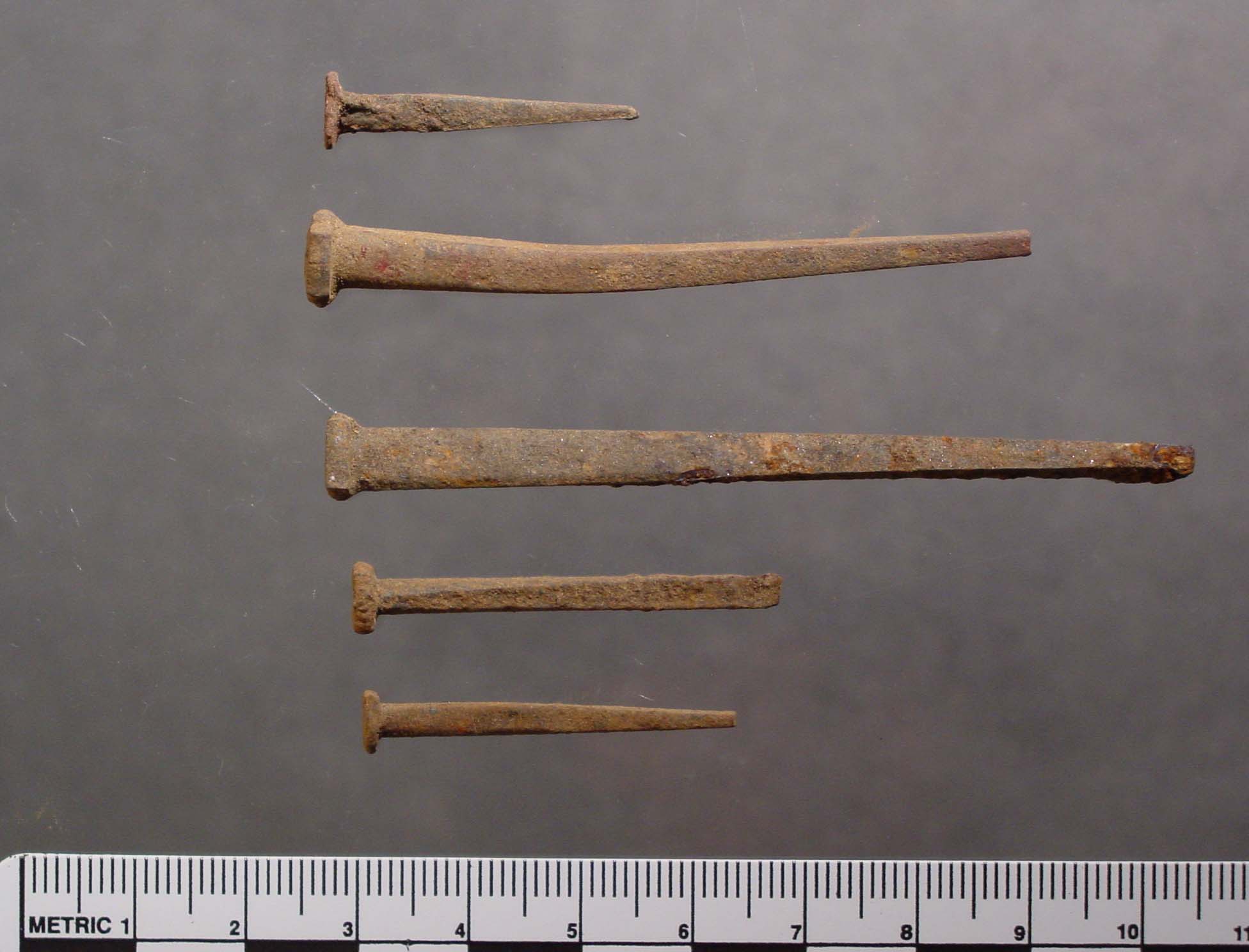
Photo credit: www.past-inc.org
|
Methods
The artifact data from the project area in the El Dorado National Forest came in the form of one large layer file of points. The volunteers used topographic maps for navigation in the search areas and so the GPS was set up to record the data with the same coordinate system as the maps. When I received the data it had already been projected into WGS1984. I projected it into the more convenient coordinate system of NAD1983_California_Teale_Albers. The problem remained that every type of point data that recorded with a GPS was in this one enormous file.
Elevation data for El Dorado County from The National Map came in the form of four indices that covered much more area than EDC. The four tiles were mosaicked together via the Mosaic to New Raster tool and trimmed to the shape of El Dorado County via the Extract by Mask tool. A Hillshade was applied to the EDC elevation raster to create a more detailed representation of elevation. The elevation raster was then used to create a slope raster via the Slope tool. The slope raster symbology is interesting but was even more revealing with a black to white, stretched color (inverted) to show the areas with the least slope (most level) as white and varying degrees of dark the steeper the region is.
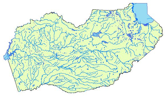
Geodetic, transportation, and hydrographic data were obtained from The National Map and The National Oceanographic and Atmospheric Administration and clipped to the shape of EDC. Three layers representing water sources, streams/rivers and ponds/lakes were created from the hydrography data. The transportation data was used to create named roads, unnamed roads and highway layers. The layers were imported into a File Geodatabase for ease of use and common symbolization.
|
|
Sample of the Raw GPS Data
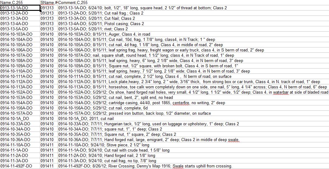
Table credit: Seth Owens
|
|
Types of Data
I determined that there were four different types of point data within the larger entity:
- Points used on the GLO maps to identify the trail.
- The Trails West, Inc monuments marking the start of the trail.
- Trail Section points used by the metal detecting crew to mark the start and end of subsections of the trail.
- The found artifacts themselves, including two graves.
Additionally there was a line feature created to note the route of the trail based on the artifacts that had already been found and the GLO routes.
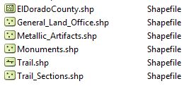
Photo credit: Seth Owens
| |
|
Acquired Data
I acquired much of my data from The National Map, run by the USGS. Elevation data for El Dorado County was in the form of 4 indexes that I mosaicked together with the "Mosaic to new raster" tool. The resulting mosaic was masked to the shape of El Dorado County, also obtained from The National Map.
Elevation Raster
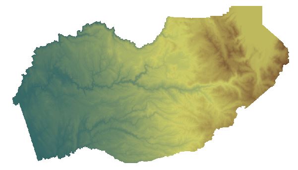
Photo credit: Seth Owens
A hillshade and other elements were added for aesthetic and reference effect.
Hillshade Raster
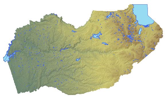
Photo credit: Seth Owens
Local Roads
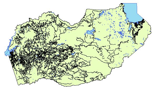
Photo credit: Seth Owens
Water Features
|
|
Results Why did the emigrants take the route they did? Using the elevation raster I created a slope raster. Dark green represents the least amount of slope. It stands to reason that they would not travel up steep terrain unless absolutely necessary.
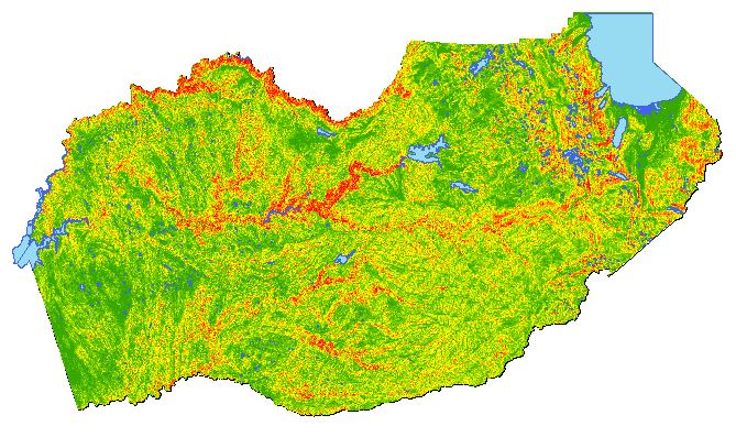
Photo credit: Seth Owens
Slope in the project area adjusted to a stretched value with white representing the least slope.
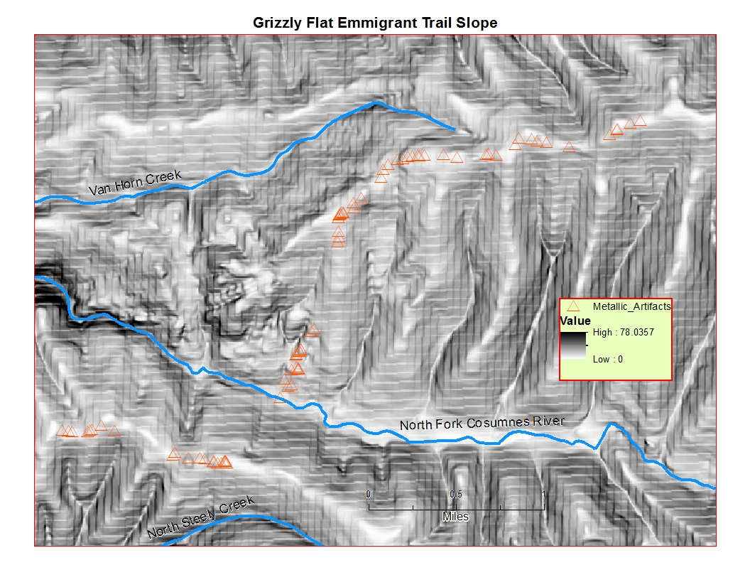
Photo credit: Seth Owens
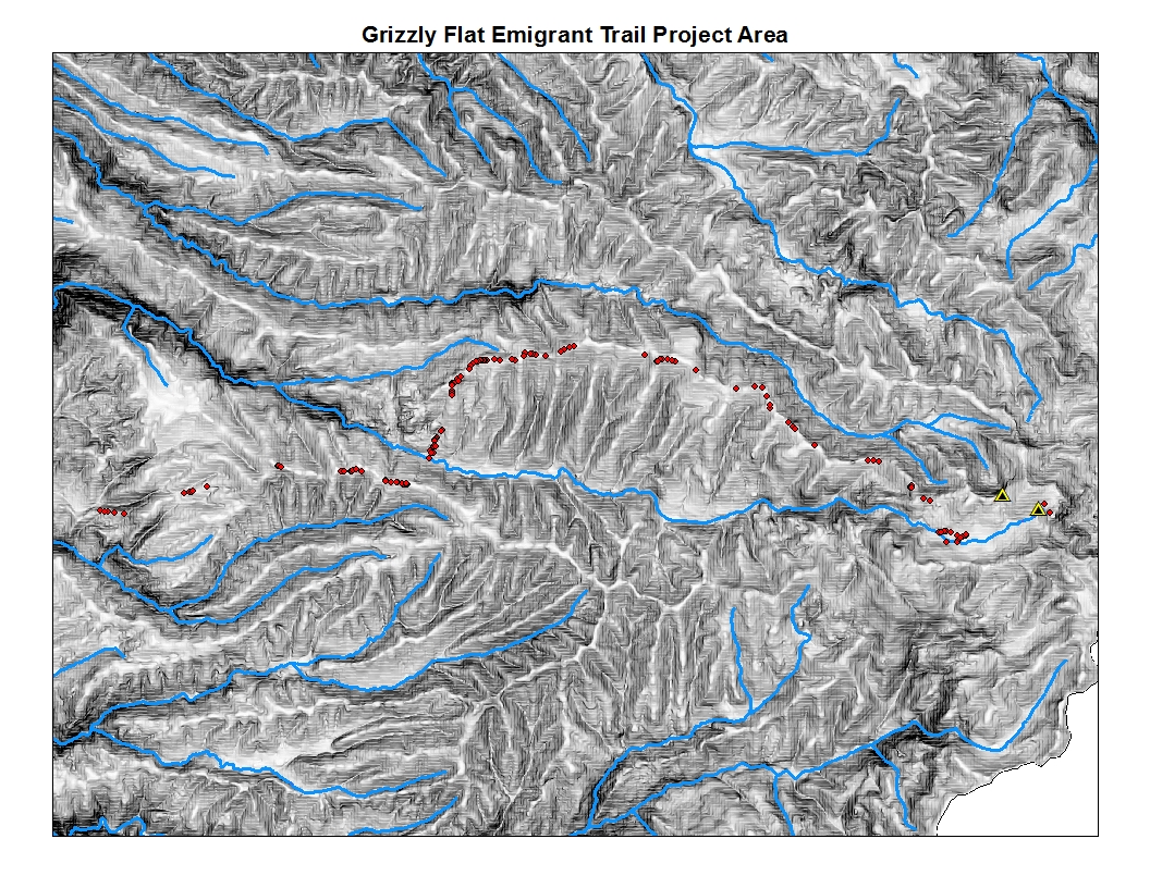
Photo credit: Seth Owens
Predictions The Grizzly Flat section of the trail has yet to be fully located. The project has been ongoing since 2010. The farthest parts of the trail vector data are an estimation of the trail location based on the GLO maps. Having started with just a shape file of assorted point features I lack enough elements to run a model that might predict the path of the emigrant trail but visual determination of the area suggests some likely routes.
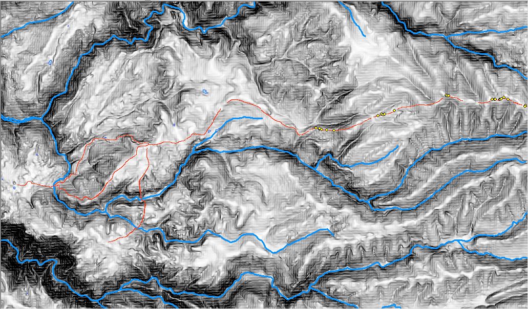
Photo credit: Seth Owens
|
Analysis Due to the occasionally glitchy ArcMap the most difficult process was the mosaicking of the El Dorado County Elevation raster index segments. The process failed 20+ times before working perfectly. Creating the shape of El Dorado County to clip other maps to was simple enough as were the creation of the other sub data such as roads, rail and water features. National Map provided its data in large, non-differentiated chunks so features such as roads were split into multiple layers representing named roads, freeway/interstate and unnamed roads. I never did acquire a road feature for OHV's and forest service roads. It is known (and not unexpected) that one roughly follows sections of the trail.
|
|
Conclusions The purpose was to take a lump of data and present it in a form that might be more useful for predicting the route of the Grizzly Flat Emigrant Trail and other trails in El Dorado County. Future additions to the file geodatabase should include enough data to create a least cost path analysis. Creating a database of locations for all the emigrant trails in El Dorado county will of great value for planning and utilization of the El Dorado National Forest. |
|
References
Black, B. and L. Farrington, R. Schmidt, L. Trails West, Inc, 2010. Carson Trail Driving Guide. 1st ed.
|
|
|